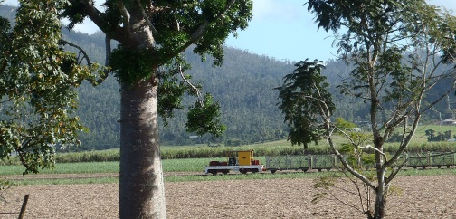
For most of the 500 people in the Feluga area, there is just one neighbouring house within 100 metres. Since cane paddocks cover almost every square metre of land between the houses, a significant quantity of residents are workers in the sugar industry. Even those, not on a farm typically have acreage. Between June and December, the cane harvesting season is in full swing with haul-outs and harvesters operating night and day and during the season, the steaming stacks of the Tully Sugar Mill are visible throughout the valley.
Surrounded by low hills, the valley is criss-crossed by a multitude of creeks that work hard in the wet and loiter in the dry. The entire Feluga area remains green for almost the entire year and the green cane fields merge into the green hills that form crab like enclosing pincers for the valley. Mt Mackay and Mt Tyson, near the closest town of Tully, 8 kilometres away, dominate the view south.
For most people, the effects of a tortuous night in February 2011 when Cyclone Yasi wreaked havoc across the valley, are still a painful but fading memory. The belligerent and stoic attitude towards that natural disaster sums up the local attitude to most hindrances; the large crocs that frolic in the local rivers, the snakes seen occasionally in the cane fields, the heat before the wet breaks and the drenching 5 metres of annual rain.
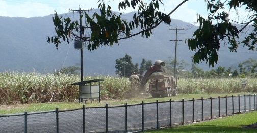
(Feluga State School bus stop.)